On March 5, 2020, a new Martin City Area Plan was adopted by the City of Kansas City, Missouri.
Area plans recommend strategies to help realize a community’s long-term vision for the future and provide a comprehensive framework to guide public decisions on land use, housing, public improvements, community development, and city services.
MARTIN CITY AREA OVERVIEW
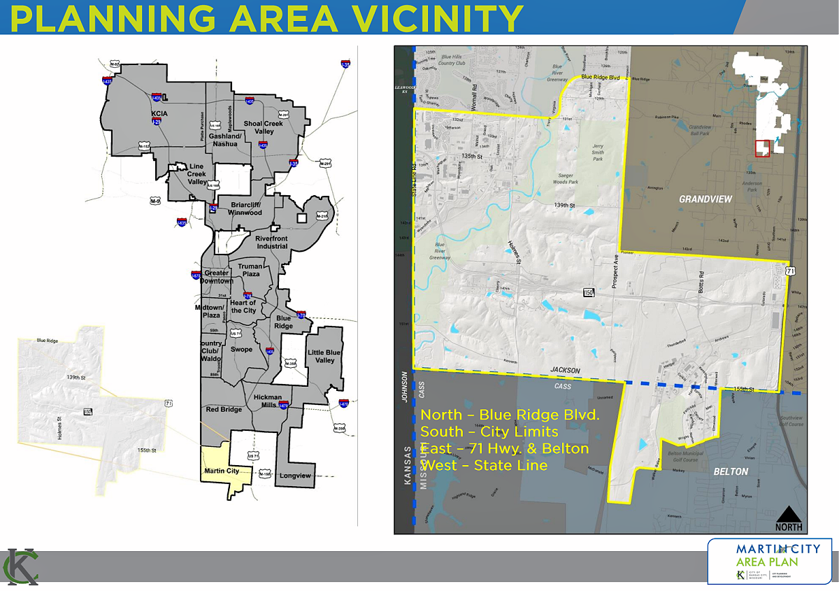
The Martin City Planning area encompasses approximately 11.5 square miles of land in the 6th Council District of Kansas City, Missouri. Historically it was founded near 135th and Holmes Streets was originally named Tilden in 1887. The town name was changed in 1895 to Martin City, most likely because there was another town of Tilden in Dallas County, MO.

AREA DESCRIPTION
Currently, almost 60% of the plan area is undeveloped, mostly near the Blue River Corridor, due to the lack of infrastructure, stream setback issues, and a significant amount of property owned by the public.
The northwestern portion of the plan area, north of 150 Highway, is what people often consider to be “Downtown Martin City.” It is a mix of mainly residential and commercial uses anchored by the 135th Street and Holmes Road Corridors. The eastern portion of the plan area is largely for industrial uses and is the location of the former Richards-Gebaur Airport Facility – which now serves as a light industrial center – and the Honeywell development in the vicinity of Botts Road and 150 Highway.
While the population is modest in this area (approximately 2,200 residents), the private sector investment and associated jobs are significant. Since 2012, led by the Honeywell FM&T development, over $900 million in private investment has occurred in the area. Overall, the area is a job importer having approximately 7,500 people working there every day, while exporting approximately 10% of that number to other areas of the City.
The plan area is well served by the highway system, which includes 150 Highway running through the center of the area providing access to the regional interstate system. The area is also well served by rail, which is important for industrial uses.
Currently, public transportation service is limited to one bus route which connects the state line retail shops located in the traditional urban neighborhoods directly to the north of the plan area. There is great potential for the development of trail and bicycle infrastructure in the area due to the amount of property along the Blue River that is owned by the City and Jackson County. The system is limited at this time as those facilities are not developed.

